
The Basics Six miles (9.5 kilometres). This vast area of forest and parkland is the Dukeries, formerly the ducal estates of Welbeck, Thoresby and Clumber. All three have ‘fallen from their Graces’ but Clumber lives on as the regional H.Q. of the National Trust, with the area taking on a new role as a popular country park. This longer walk encompasses many less frequented parts of the parkland, but includes part of the delightful lake-side track and the self-service cafeteria – of course. It’s mixed tarmac and footpaths. Before you go Look in Google for information on Clumber Park, Hardwick village and the Duke of Newcastle. Binoculars are worth taking. Click on here to watch a short video.


A stroll in the heart of Sherwood Forest

How to get there
From Nottingham, take the A614 to the Ollerton roundabout, second left A616 through Budby, then right on the B6034 to Worksop.
About 1 mile south of the A57, take the minor road on the right, signed to Clumber Park, to Truman’s Lodge, a secondary entrance to the Park.

Just before the Lodge, bear left and continue for .4 of a mile, (.6 km) parking at a small layby on your left at the first track crossing-point. Map Ref. for the parking spot is SK611 761.

From Worksop and other towns north, take the B6034 to the minor road 1 mile south of the A57, then as above. From Retford it can be reached by turning off the A57 at Manton Lodge, parking on the right.
The Walk Start

Cross the road, but go left immediately after the barrier, following a narrow track parallel to the road to meet the next broad bridleway by a barrier, then turn right.

Continue through the wood on a wide path, with a mixture of conifers and broadleaved trees.

You will pass this useful display map that shows you are on the Blue Route, towards the extreme northern end of the Lake. Cross an open space to reach the famous Limetree Avenue, planted in 1772, and now the longest (2 miles) stretch of double lime trees in Europe.

Go straight across to re-join the clear path ahead, through open spaces and woodland. Ignore Route 8 branching right, cross a road and finally reach the end of the Lake.

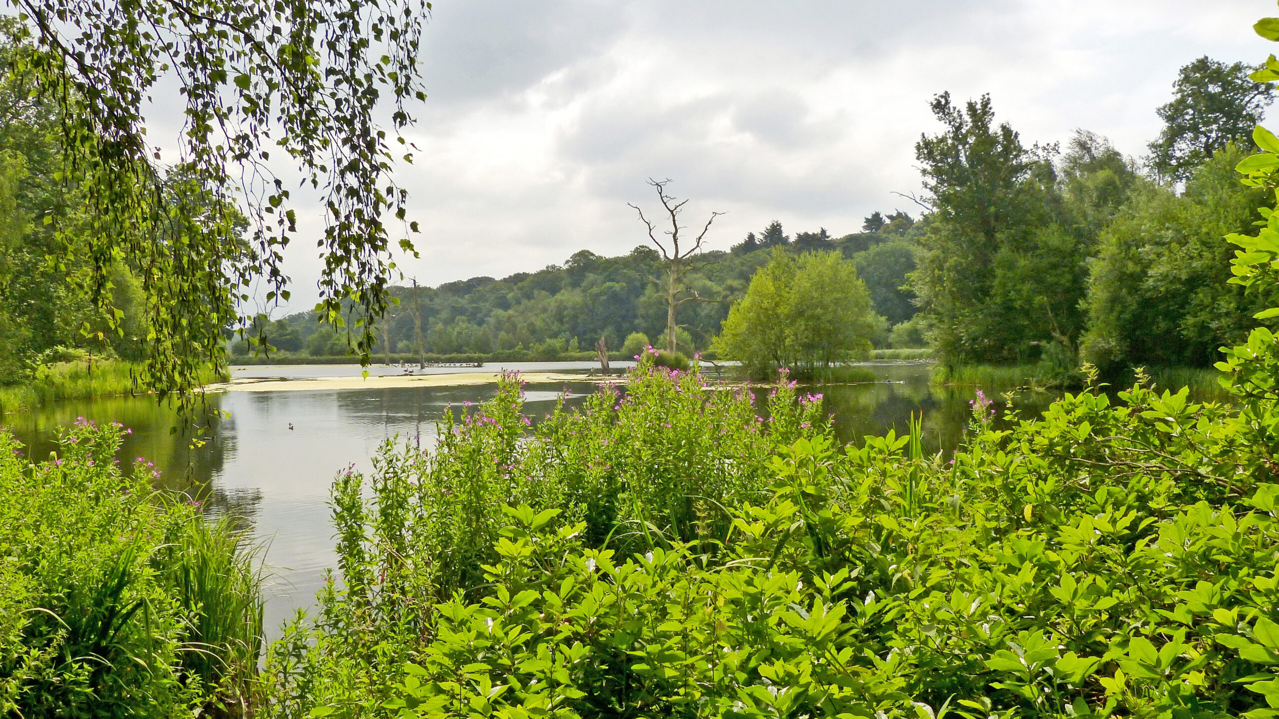
This shallow water attracts many varieties of water bird all times of the year – ducks, Canada and Egyptian geese, coots, moorhens, swans, great-crested grebes and others.

Keeping the Lake close on your right, follow the winding path through trees to the road.

From this spot (Point 1) you can either continue on the lakeside path to the bridge over the River Poulter, by-passing Hardwick Village, or turn left on to this road to Hardwick. Turn right at the top as indicated by the sign.

The houses here are now mainly privately rented, rather than occupied by the former estate employees.
Pass down the main street, turn right at the sign ‘Social Club’ to reach an open space usually occupied by cars.
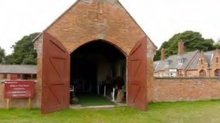
On Wednesdays, April through to October only, an interesting exhibition of farming and agricultural equipment can be seen here. It’s free, and well worth a chat to the knowledgeable exhibitors.

Some 40 yards to the left of this exhibition, take a narrow path left of a building, down towards the lake, passing toilets on the way and emerging next to a stall selling drinks etc.

Turn left here, with the lake on your right again, crossing the bridge over the tumbling Poulter at Point 2, to follow the wide footpath along the southern bank of the lake. It passes mainly under trees, with glorious views over the water, notably of the church of St. Mary the Virgin, commissioned by the 7th Duke of Newcastle, and dedicated in 1889.


You may catch sight of cheeky young elves outside their adopted palace. Almost opposite the church look for a relic of the dock used by the ferry taking the Duke’s guests from The Battery the across the lake for the walk you’re enjoying. But more than likely they had a butler serving Pimm’s and strawberries. Time to get out your sarnies?

Past the car park and just before Clumber Bridge, by the wide waterfall, you may enjoy close-ups of ducks, swans and cygnets soliciting for food.

As the path reaches the bridge at Point 3 keen bird-watchers may like to detour a few yards to the left on the road to South Lodge, where the layby often harbours car-drivers quietly watching blue tits, great tits, chaffinches, nut-hatches and the occasional greater spotted woodpecker or jay feeding from bird-tables.


In the spirit of its surroundings, the Clumber Bridge is classical in style. The view right is busy along the length of the lake. The view left is quieter, but may reward you with a delightful sunset in the evening.

You can reach the visitor facilities along the road, but it’s longer. To avoid car traffic you may prefer to take the foot-path to the right, immediately over the bridge, following it through woodland with the lake again on your right, to a road. Children might enjoy a brief visit to The Grotto as you pass.

Turn right here and continue on grass or tarmac to where the lake becomes visible ahead of you. Go left then right (toilets on the corner) to access shops, café/restaurant, cycle hire centre, the National Trust Regional Offices and the grassy vista formerly covered by the Duke of Newcastle’s stately home. He’d be horrified to see what the geese have done to (and on) his floor.


When you’ve had enough, your route continues left (north-west) for half-a-mile along the main road, at first with cars parked both sides (with an ice-cream van in summer), then past a wide grassy area with a cricket field, followed by signs to the walled kitchen garden to the right. This is open daily 10 am to 5 pm, free to National Trust members, with occasional special events.
Shortly after an entrance kiosk, Lime Tree Avenue crosses your path again, at Point 4.


On the other side, bear right within a short distance on to the first footpath, continuing straight ahead through delightful woodland for 3/4 mile (1.2 km). Very shortly after passing under this carefully-grafted plastic bottle-tree you will realise that you are face to face with your transport on the other side of the lane. You’ve done it. And perhaps you’ve found there’s a bit more to Clumber Park than at first meets the eye. There are many more footpaths you can explore. Click here to watch a short video.

This walk was updated and partly revised in September 2014, incorporating several modernising changes over the 20 or so years since Peter Fooks first walked it.
Please note – further changes can occur at any time, for which we cannot accept responsibility. If you are aware of any significant alterations, please notify me at briancluff@talktalk.net. That would be very helpful to everyone. If you enjoyed the walk – or not, please let me have any useful comments.
Click to enlarge map
